Left and right branches
At the intersection of the mainstream and the tributaries with the water, from the downstream to the upstream, the right brook is called the right branch (xi), and the left brook is called the left branch (xi). If an equal amount of turbulent brook is divided from the left and right branches, it is called the middle branch (stream).
Left Bank and Right Bank
Streams have been established along the streams. Looking from the upstream to the downstream, the right bank is called the right bank and the left bank is the left bank in the flow direction.
Hop waterline dividing line
The watershed is the ridge line, and the waterline is the valley line. In a topographic map, it is usually a watershed line where the convex portion of the contour line faces the mountain, and a water line line where the concave portion of the contour line faces the mountain.
Catchment area
The catchment area refers to the area enclosed by the drainage line of the basin. Most of the catchment area is determined from the topographic map firstly, and it is calculated by a planimeter or other method. The unit of calculation is square kilometers.
Lower than
Also known as slope drop, slope, refers to the change of the vertical scale within the horizontal distance of the water surface. The elevation difference along the river in the reach of the river is compared with the length of the corresponding river and is called the vertical drop of the water surface. Due to the effect of centrifugal force on the rotation of the earth and the curvature of the river, the water surface of the cross section of the river is not even, and the ratio of the elevation difference of the left and right bank water surface to the width of the river corresponding to the section is called the aspect ratio of the water surface.
Canyon and creek
"Canyon" refers to the narrow, steep rocky terrain on both sides of the valley. The "gulf" is wider and longer than the canyon. In general, canyons occur in the upper reaches of the valley, and most of them occur in the middle reaches due to the deep and extensive erosion of the riverbed.
Boulders
In the creek bed, piles of large rocks, often called "boulders," can be seen climbing through the huge stone piles.
Rock wall
Because of the steep terrain and the lack of vegetation, the rock bald forms a “rock wallâ€. If both sides of the valley are rocky terrain, they form a canyon.
Rock Cave
The crevices in the creek often form "rock caves" due to erosion, or artificially cut caves.
Wall collapse
The ridges or ledges on both sides of the valley are often collapsed due to mining, earth and rock, or heavy rain, resulting in the formation of "wall collapse" and "disintegration."
Deep pool
The creeks at the bottom of the creek will also cause the stagnant streams to gather together and call them “tanksâ€. If the water depth is more than one meter, they will be called deep pools. Streams running through canyons or creeks also often cause falls and deep pool terrain.
waterfall
When the creek slope suddenly becomes steeper, the vertical or vertical drop of the water flow is called a “waterfallâ€. Waterfall is a common topographic landscape in the valley, and it is also a difficult site for the tracer to overcome. If the time taken to attack the top is several times higher than that of the high winding, it usually takes a lot of winding.
Waterfall
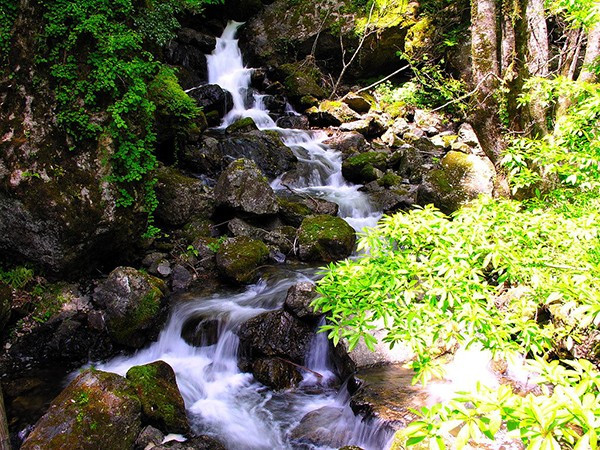
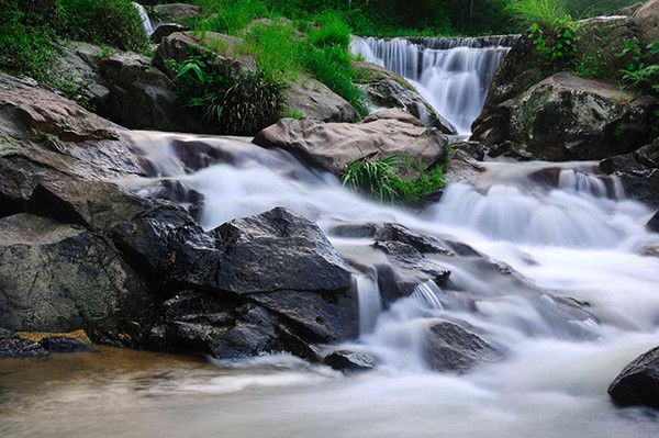
As the stream flows rapidly through the large rocks on the creek bed, it produces a waterfall-like scene. When the rock is not vertical but inclined, the rock is called "talc." If the slope is less than 45 degrees, it is called "Talc Waterfall" or "Slide Waterfall"; if the inclination is reduced to less than 30 degrees, it is called "Slip" or "Talc"; if it is tilted to within 10 degrees or there is almost no inclination, It is called "sliding bed." In general, the waterfall has a good footing point in the running water, which is conducive to tracing back; while the talc is relatively flat, the erosion of the stream is weak, but the whole rock surface is slippery and easily out of the situation.
Volcanic flow
When a stream reaches a certain area, it will submerge into the ground and become a “fluid currentâ€, with a large amount of sand flow. Some streams in the upper reaches of the river are often covered with earth and rocks as a result of the collapse of the rock on both banks or mining. In addition, during the dry season, some of the higher sections of the creek bed may be formed by the flow of water that is blocked and then submerged into the lower stream bed to form a volcanic flow.
Salon Mat
Barber station mat provides a nice, soft, durable area to place clippers, brushes, scissors or coffee machines, protect your station and countertop from damages, stains and spills.
With super traction, you will never experience it sliding or slipping around any surface you place it on, including the glass surface.
Keeps the clippers, tools or dishes in place, creating an organized work station and countertop.
This bar mat gives bartenders extra drain room for cocktail shakers to keep bar tops spill-free and sanitary.
Made from high-quality PVC with good elasticity, good abrasion and water resistance. If you have a spill on it, just rinse and air dry. Provide for safe and environmentally friendly usage.
The rubber peg-like design of these bar mats will capture the spilled liquid and keep it safe off of your bar surface. They also securely grip your glasses, preventing spilling, sliding and ultimately breaking.
Its sleek design blends into counters and stations perfectly. Ideal for barbershop, bars, home bar as barber work station mats, bar service mats, spill mats.
Salon Mat,Barber Station Mat,Bar Service Mat,Barber Mat For Clippers
Xuchang Le Yi De Import And Export Trade Co., Ltd. , https://www.alileaderbeautys.com


